The Harding Icefield and its outflowing glaciers cover 700 square miles of Alaska’s Kenai Mountains in glacier ice. The icefield is one of only four remaining icefields in the United States and is the largest icefield contained entirely within the United States.
Access to the Harding Icefield is remarkable in comparison to other large icefields. A steep (to put it mildly, hikers gain approximately 1,000 feet of elevation with every mile) trail leads from the ranger station at Exit Glacier (one of the outflow glaciers, just northwest of Seward) up to the edge of the icefield, affording visitors with a spectacular view. It's considered to be one of the most beautiful hikes in North America.
After reading about the Harding Icefield Trail, I knew we had to try the hike. We are in decent enough shape, and 4.1 miles uphill (8.2 total round trip) didn't seem like that big of a deal. The National Park website stated that it would take 6-8 hours to complete, and I figured we would be on the low end of that estimate.
We planned to hike the trail in late June, and most years a good portion of the trail is still covered in snow through July. To prepare, we bought hiking poles (which turned out to be a godsend) and heavy duty waterproof boots.

When we woke up the morning of the hike (Friday, June 28), it was raining and foggy. That left us a little discouraged, and we questioned whether or not we'd be able to see any views higher up the trail. We decided to go for it, since there was no guarantee the weather would be better another day.


The rain didn't last long, but the fog lingered for the first couple of hours of the hike. This made the first part of the trail especially difficult. There were no views to inspire us to keep going, and the dense fog had us on edge, anticipating a bear waiting for us around every corner (black bears are commonly seen on the trail, so I knew we had to be on the lookout).

I was convinced that a big rock down the hill was a bear...(of course, it wasn't)

Beautiful meadows

We kept trudging onward, higher and higher, switchback after switchback. There were a few moments when we debated turning around, but I was convinced that we needed to push on.


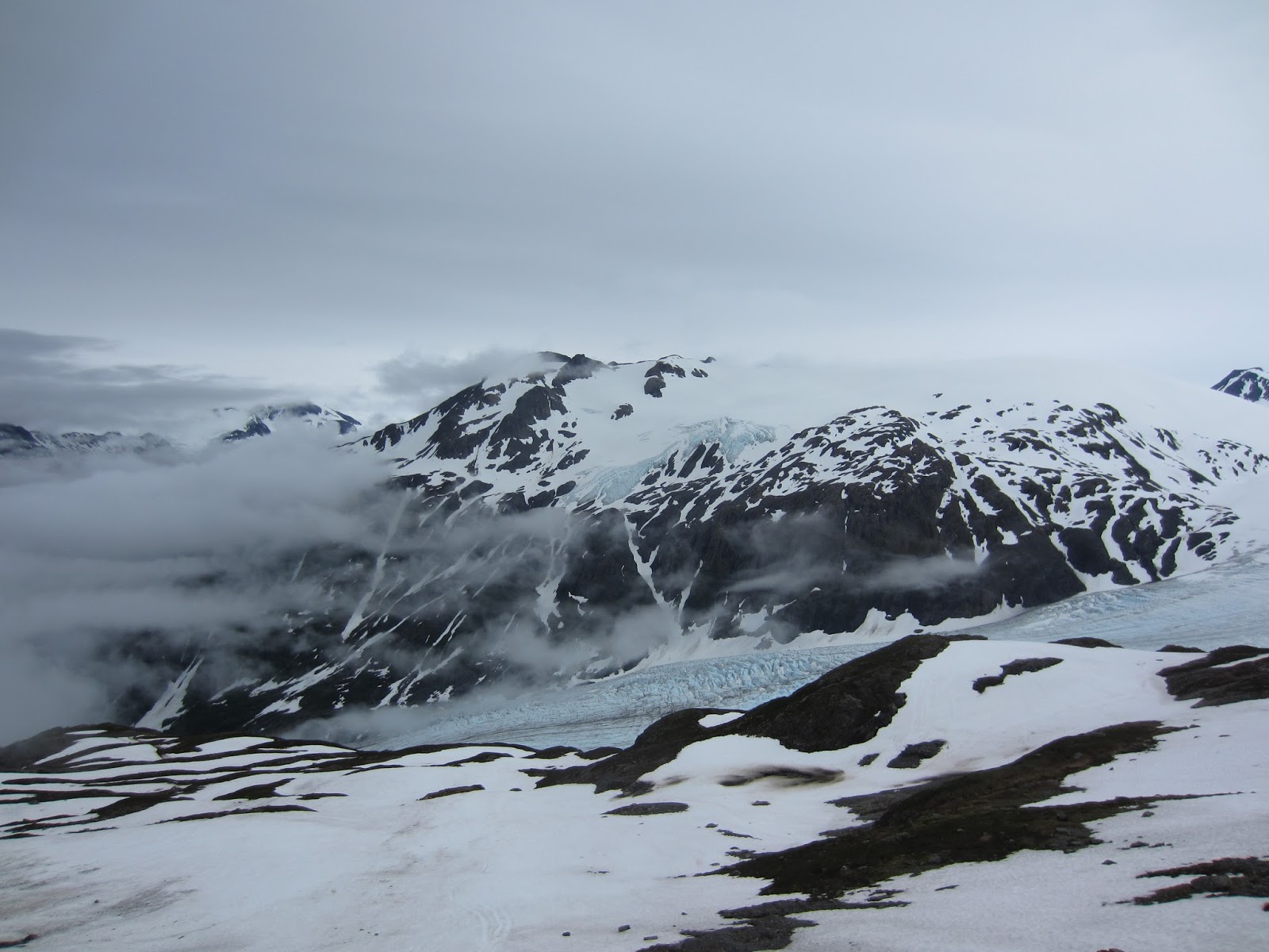
As our bodies warmed with the climb, we took off layer after layer of clothing. Finally, after what felt like forever, we saw the top of Exit Glacier peak through the fog.


Eventually, we were above the fog, and the views kept getting better and better.


At some point, we were taking a rest break and Jared spotted a ptarmigan in the rocks, an exciting find.


Look at that grin!


About 3/4 of the way to the top, the trail was covered in snow, and the hiking poles came in very handy. There were plenty of people on the trail, and it was well marked with flags, so there was never any doubt what direction we needed to go.


I remembered from a map that you pass a shelter just before you reach the end of the trail. We were exhausted at this point, but I knew the end was near.


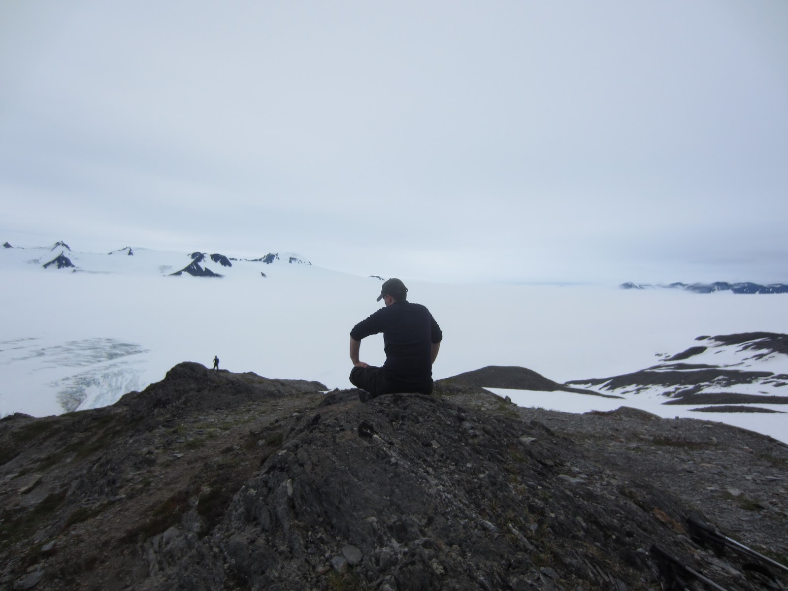
FINALLY, after a five hour uphill battle, we reached the top of the Harding Icefield Trail. To say the view was spectacular would be an understatement. We ate the rest of our food (most of it we had scarfed down earlier) and took a short break at the top. We knew we couldn't pause for long, though, or we might not find the energy to make it down.


So glad we asked someone to take our picture, proof we made it!
The hike down was almost harder than the hike up, though it only took us three hours to reach the bottom.

Looooong way down....
Our legs and knees were shot, so we relied heavily on the hiking poles for support. By that time, I realized that running three miles on flat ground every day does not equal hiking eight plus miles up and down a mountain. Though my new waterproof shoes were keeping my feet dry, I developed a nasty blister on my right heel, another rookie mistake (never hike in shoes that aren't broken in!!). I remember commenting to Jared that if we came across a black bear on the way down, I would gladly let him end my misery.
At one point on the way down, though still high up the trail, Jared found another rare bird, the Gray-crowned Rosy Finch. He was able to get a few good photos.

When we finally made it to the bottom, we were past feeling sorry for ourselves, and a feeling of incredible accomplishment overcame us. We were limping, dirty, tired, hungry, sore, and yet filled with a sense of joy that I've rarely felt before. That hike (eight hours total) was one of the most physically difficult things that I've accomplished to date, and also one of the best.
After that, all we wanted to do was binge eat and collapse. We made a quick stop by the local grocery store again, buying everything our hearts desired (think cake, pizza, potato skins...all the healthy stuff, of course). We stuffed ourselves and settled in for the evening, dreaming of the second boat trip the following day...
No comments:
Post a Comment